Yosemite
& Relief Reservoir Hikes Each of these photos can
enlarged by clicking on them. |
|||
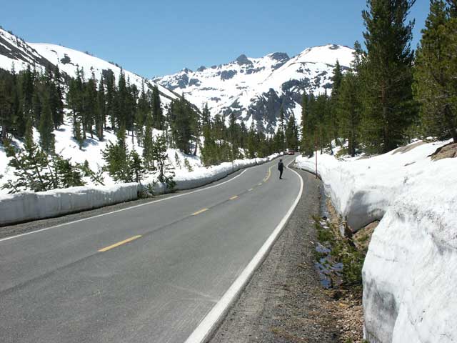 |
Leaving Obsidian campground the next morning, we drove back over Sonora Pass. The snow has been cleared from the highway but there's still a chance that an avalanche could block the road. | ||
 |
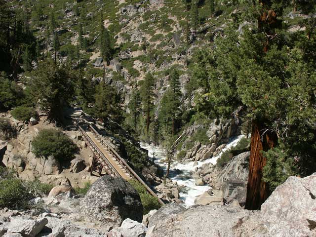
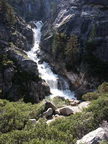
Look for the waterfall near the top of this photo.
What's interesting is that parts of the stream flow beneath the snow.
In many places the snow has melted where it contacts the ground leaving a
hollow.
Wouldn't it be exciting to be walking across the snow over the hidden stream? Then to your surprise, the snow collapses and you plunge into the icy stream which carries you down the water-filled tunnel beneath the snow? |
||
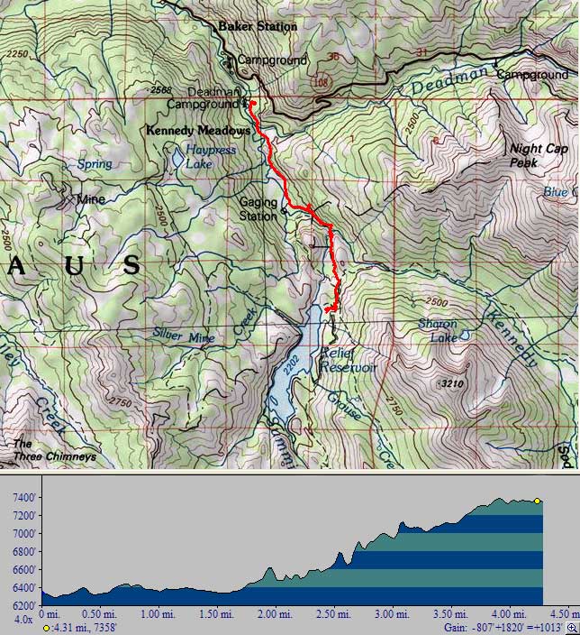 |
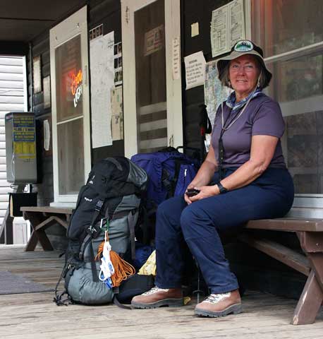
Relief Reservoir Camping Trip Our next backpacking trip was to spend two nights at Relief Reservoir in the Emigrant Wilderness North of Yosemite. The hike would be about 4-1/3 miles starting at 6,300 feet and climbing to 7,400 feet. We began our hike from the Kennedy trailhead parking lot across from Deadman campgrounds. Ray's backpack weighed 37 pounds and Betty's 30 pounds. |
||
 |
|
||
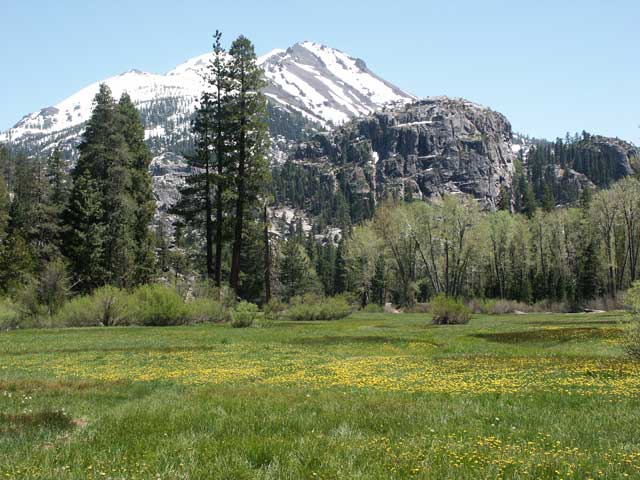 |
Flowers were in full bloom in Kennedy Meadow with the Middle Fork of the Stanislaus River on the right. Our destination is another 3.6 miles up into the mountains in the distance. | ||
 |
The Stanislaus River is raging from the snow melt. We were glad to see this bridge as we clearly couldn't cross this river. | ||
 |
The "easy" portion of the hike is over as we begin our ascent. The view of the raging river is spectacular. The power of the torrents of water is awesome. | ||
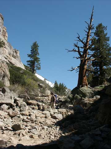 |
We are hiking on trails used by horses. To minimize damage by their hoofs, these paths have steps and diagonal dams made from the surrounding granite. As a result, you have to constantly plan each step to make sure it's secure so you don't slip. Going up is always easier than going down. | ||
 |
|
||
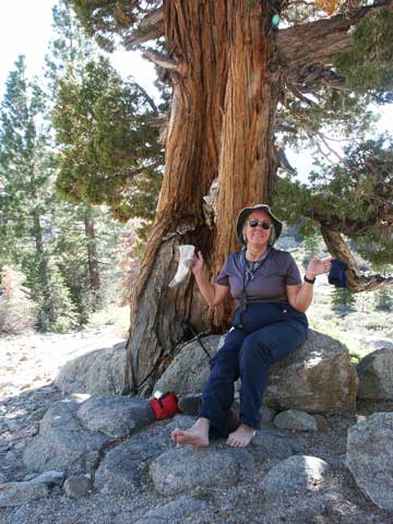 |
Blisters - even with sock liners, Betty's feet lost the battle. Time to break out the First Aid kit. The good news is that we have only a few thousand feet of trail left and a few hundred more feet to climb to reach the summit. | ||
 |
We made it! What a spectacular view of Relief Reservoir. We never know what we'll find but this was worth the climb. Next, we need to find a place to camp, take off our pack backs, and relax. | ||
 |
We found a great spot to camp overlooking the reservoir. How's this for a view from our tent. Notice the patches of snow around us as well as the snow-covered mountains in the distance. Nobody's been here since winter except for one hiker and a couple of horses. | ||
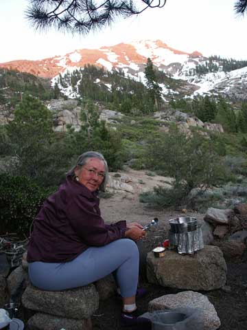 |
After setting up camp and exploring, it was
time for dinner. Betty looks cold but it was actually comfortable.
We're having Betty's famous noodles and clams for dinner as the sun sets on
the snow-covered mountains. (If you look carefully, you can see a mosquito on Betty's forehead.) |
||
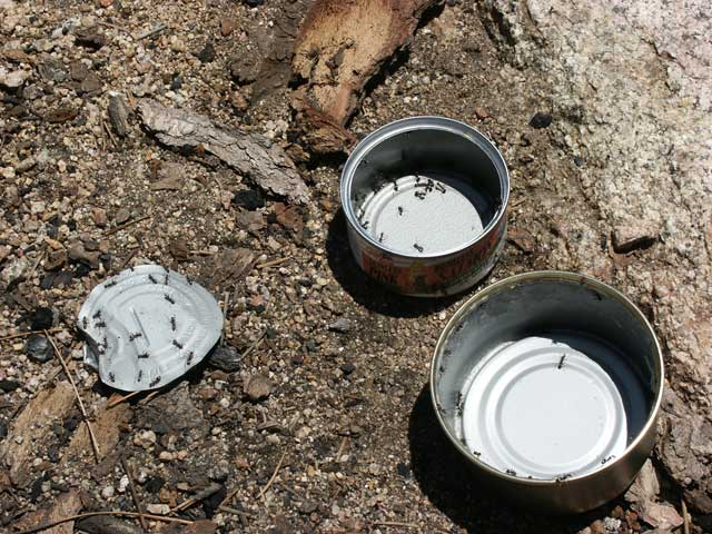 |
The ants were busy but didn't bother us. After dinner we gave them a treat. They preferred Chicken of the Sea salmon over Trader Joe's - but we preferred Trader Joe's. Guess the ants aren't connoisseurs. | ||
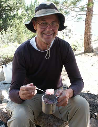 |
Ray invented a new desert. He took nearby
snow, added cranberry drink powder, and - voila, enjoyed a delicious snow
cone. It was rather warm, even at 7,400 feet elevation. During the day it reached 82 and the lowest it got during the night was 42 degrees. Many of the snow patches shrank during our 3 day stay. |
||
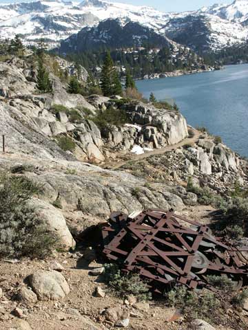 |
There's a lot of history in this area with
remnants of heavy steel machinery along the trail and lakeside. We saw
several old steam donkey engines and other historic evidence of the dam
construction and pioneer crossings. In the foreground is what appears to be a tram that was carried on cables down the hillside. |
||
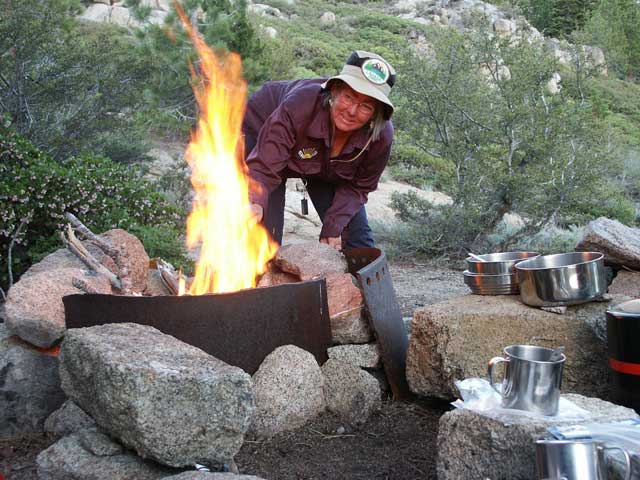 |
At our campsite, previous campers had added steel sections of a steam donkey to a fire ring. Although it wasn't cold, Betty said we needed a fire to keep the mosquitoes away. (We only had mosquitoes in the early morning an for an hour in the evening.) | ||
 |
Well it was time to go home. We got up at
6:30 am, packed, and were on our way down by 7:36. By 9:15 we'd
descended 1000 feet and arrived at the resort at 10:22. This is another view of the Stanislaus river which we paralleled for a good portion of the trip. |
||
 |
At the resort store, Betty enjoyed a cool V8
drink. With our backpacks off, we "floated" for a while. What a great trip! |
||
 |
|
||
