San
Benito Each of these photos can
enlarged by clicking on them. |
|
|
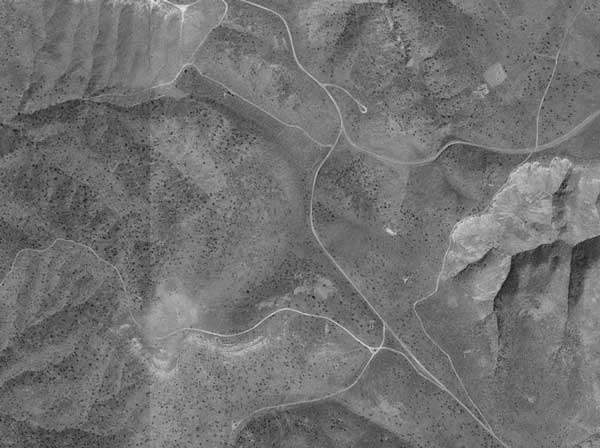
The first part of this trip was to drive the roads in Panoche Hills shown in this satellite photo from terraserver. Then we drove the 40 mile loop in the Clear Creek area near Coalinga (map further down). |
 |
As you can see in the satellite photo above, you'd better take careful notes of where you are or bring a GPS
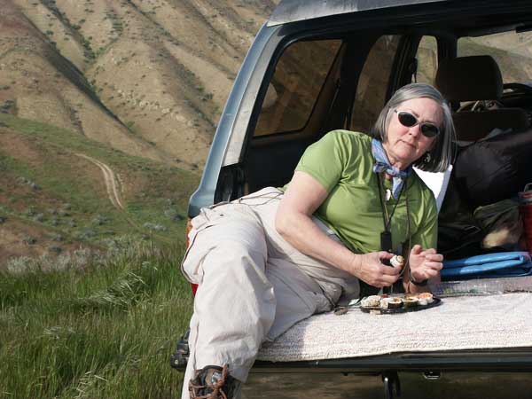
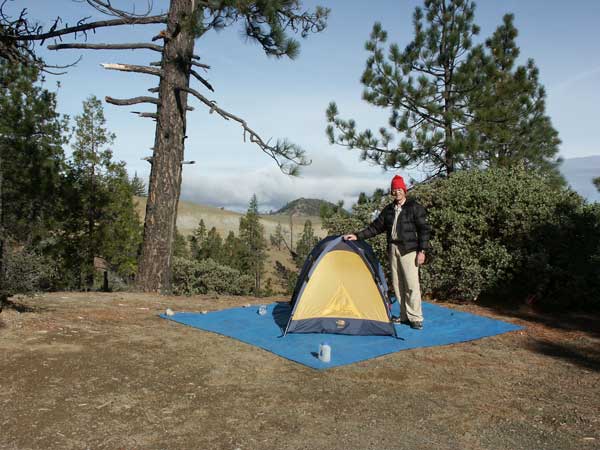
like we did or you're sure to get lost - and no one is around to help! Time for lunch. Betty has such class! Overlooking the winding roads, we ate sushi on the tailgate while surveying the terrain below. |
 |
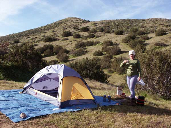
That afternoon, we found a nice secluded spot to camp nestled behind the hills. We were serenaded to sleep by the howling and yipping of coyotes down the canyon. |
 |
And in the morning we drove out of the Panoche Hills and headed for Clear Creek. To get around the mountains between them, we drove about 100 miles SE to Coalinga along Highway 5. Then took a road that roughly follows the San Benito river to the West entrance to the Clear Creek area. |
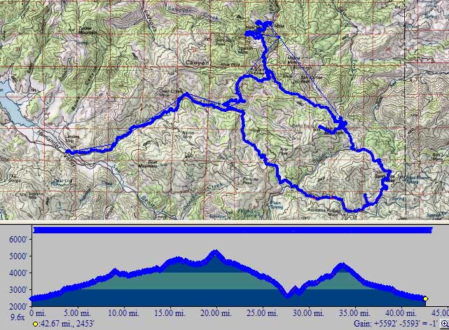 |
This is a map of the Clear Creek area. We started from the left, looped around counterclockwise, took the spur to the top, then continued out the way we came in. These are definitely 4-wheel drive dirt roads with lots of holes, rocks, and mud puddles to negotiate. Betty now wants a wrench for the 4-Runner. |
 |
The first day we drove the bottom leg and halfway up the right side of the loop on the map above, camping that evening at the small jog to the left. He hiked another 570 feet up to the summit at 5,241 feet. In the cold morning the valley had a light cover of fog and we could see the snow topped Sierras. |
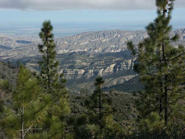 |
This photo is looking East. The city of Fresno is 100 miles away. We broke camp and continued on our journey. |
 |
Continuing along the map, we continued counterclockwise around the loop and decided to visit the ghost mining town of Idria. It's at the top of the map. There roads weren't marked so we drove up a few dead end tracks (too rough to be called roads). |
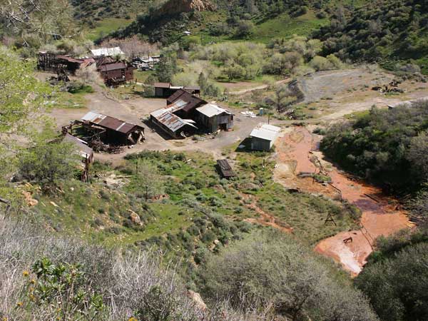 |
Here's Idria. You can see a lot of reddish mud seeping from the mine. There isn't much to the town. The road down is quite steep with some deep holes and drainage trenches crossing it. Driving out we saw a sign saying it was private property. They clearly don't want visitors. |
 |
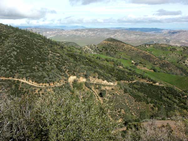
Driving our from Idria we saw this beautiful scenery. Views like this make driving these rough roads worthwhile. |
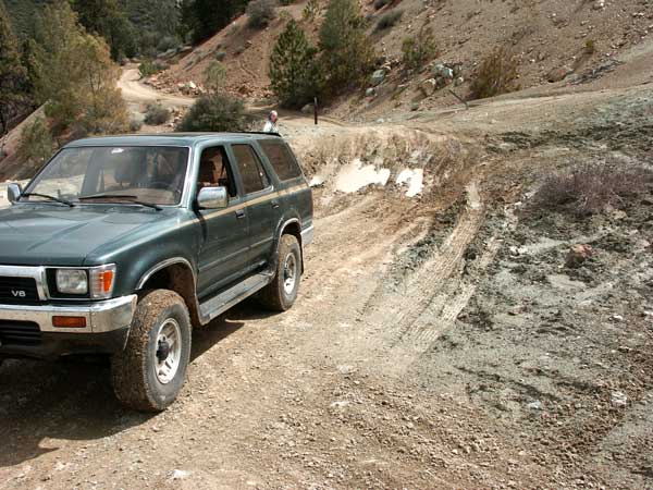 |
Maybe I should retract the last sentence. On our way out from Clear Creek we found the road closed with a detour. Right away I knew this was going to be a challenge as we climbed the steep road for a few miles - then we hit his spot on a side of the hill. The choice was to go back 30 miles or continue through this hole of unknown depth. All four tires slinging mud and with a fervent prayer - we made it across. |
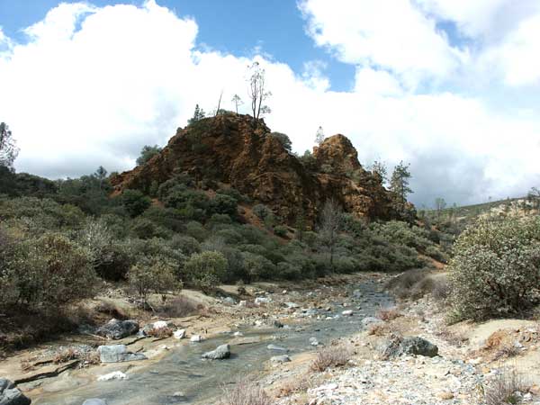 |
On our way out from Clear Creek, we drove along the stream. |
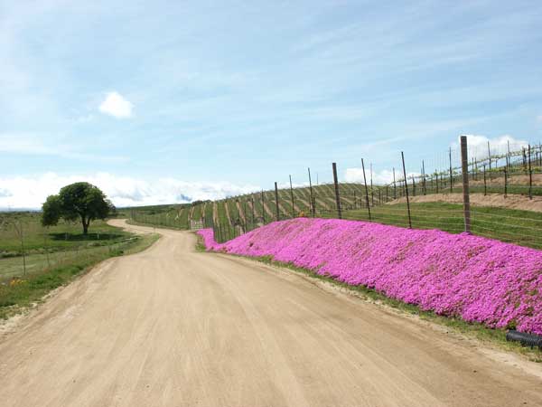 |
After leaving Clear Creek we passed this winery with its ice plant in full bloom. |