|
Our
5-day backpacking trip in the Muir Wilderness Each of these photos can enlarged by clicking on them. |
|
|
|
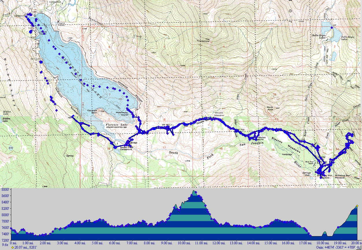
We arrived at Lake Florence at 5PM Tuesday. Starting at the upper left corner of the map, we hiked about 2 miles and camped along the lower edge of the lake. Wednesday we hiked about 7 miles to Shooting Star Meadow. Thursday we broke camp and attempted to hike to Sallie Keyes Lakes but we started too late, it was too steep, and the weather looked bad so we returned to Shooting Star. Friday morning we headed out, staying midway at Blayney Meadows campground. Saturday we hike to the lower corner of Lake Florence where we took the ferry across the lake. The total trip was 20 miles. |
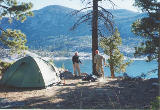 |
A beautiful view of Florence Lake from our first night's campsite. I started the camera's self-timer but didn't make it back to Betty before it went off! (The camera's too fast - I'm not that slow!) |
 |
Wednesday afternoon, we are now at the lower end of Florence Lake. We stopped to soak our feet, did a little fishing, and had a leisurely lunch. Then we started the climb up the mountain. |
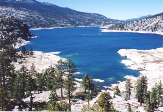 |
A magnificent view of Florence Lake. It really was this blue. |
 |
We finally arrived at Shooting Star Meadow and set up camp
near the river. There's bear scat around so we were glad to bring
our bear canister. We hung our other stuff in a tree. As we
don't bring smelly (meat, etc.) food, we aren't too worried about the
bears.
Finally it's dark and Betty just loves a campfire. |
 |
Thursday we got a late start leaving for Sallie Keyes Lakes. Switchbacks and just tough climbing as we climbed from 7,800 to 8,800 feet in less than 2 miles. (It wouldn't have been so bad without backpacks.) |
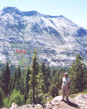 |
We quit the climb at 8,800 feet. Our camp site is at
the bottom of the green patch on the mountain. Sallie Keyes Lakes
are at roughly the same elevation as the top of this adjacent mountain.
We returned to our camp for a good night's rest and the next day, Friday, began the long hike out. |
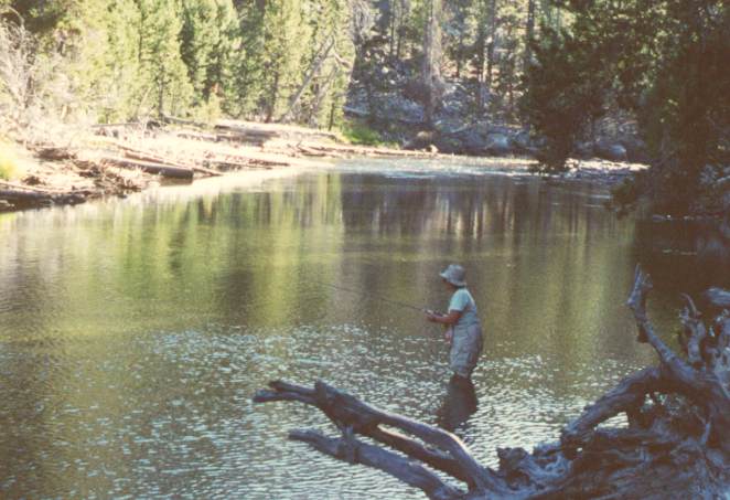 |
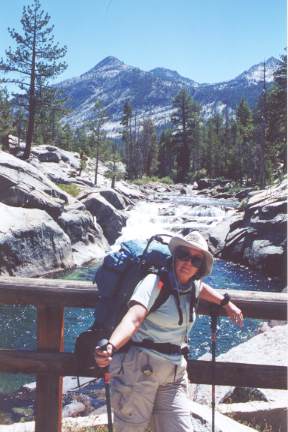
Betty's catching us dinner as we camp at Blayney Meadows. The water was freezing. She wanted to build a camp fire to warm up but it wasn't even dark yet! That evening we had those delicious trout and the campfire. |
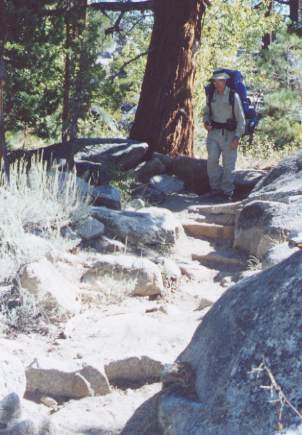 |
I don't know what's tougher - going up these
"stairs" or down them?
I'm amazed watching the horses navigate the rocky terrain. The larger boulders and huge slabs are slick from wear - yet the horses don't seem to slip. Their paths across the slabs are faintly rust-stained from the steel horseshoes. |
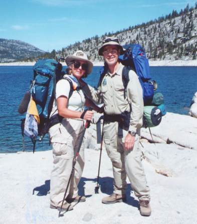 |
Finished hiking, we're are anxiously waiting for the ferry to take us back - sure beats hiking 5 more miles. Notice how the weight of our backpacks made us shorter! |
 |
And now for a shave and a hot bath as we return to civilization! |